
Sign solutions / A buyer’s guide
Wayfinding
Interior + Exterior Navigation
A coordinated path from the first arrival decision to the final destination.
Category-level comparison, not a quote. Site size, destinations, maps, structures, sign quantity and installation scope change the project.
What is a wayfinding system?
Wayfinding is a coordinated system of names, maps, directories, directional signs and destination identification that helps people understand a place and choose the correct route. It can begin at the road or parking entrance, continue across a site or campus, and connect to interior directories, corridors and room destinations. The route, message hierarchy and sign locations should be planned before individual sign shapes are selected.
Arrival / decision / destination
Information along the route
A useful system reveals information in sequence. Establish the route and the decisions people must make, then assign the appropriate sign role to each location.
Arrival & orientation
Site identity, directories and overview maps
Arrival signs confirm that a visitor reached the correct place and provide the first useful overview of destinations, zones or routes.
- Best use
- Property entrances, parking arrivals, trailheads, lobbies and other points where visitors need to understand the site before moving forward.
- Plan from
- Approach direction, entry sequence, destination list, site map and the next decision point.
Directional & decision-point signs
Arrows and destinations placed where routes split
Directional signs answer the next immediate question without forcing a visitor to read the entire property directory again.
- Best use
- Road intersections, parking circulation, trail junctions, corridors, elevators and other locations where people choose between routes.
- Plan from
- The decision point, allowed movements, destination priority and the viewer’s travel speed.
Destination & zone confirmation
Confirmation that the visitor has arrived
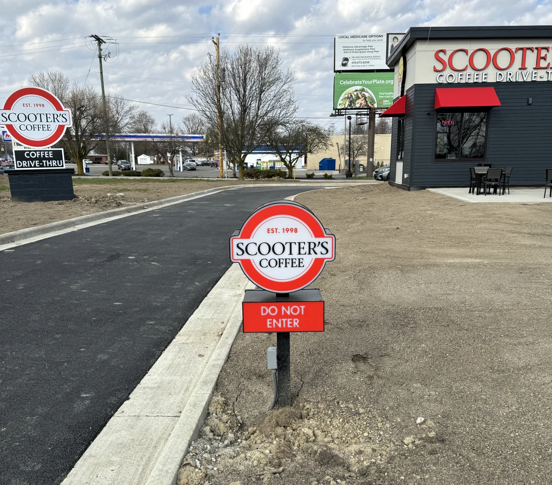
Destination signs name the building, area, service, tenant or final location and reinforce the naming used throughout the route.
- Best use
- Buildings, departments, loading areas, visitor parking, trail destinations, tenant zones and facility entrances.
- Plan from
- Approved destination names, zone system, viewing direction and relationship to building or room identification.
Messages / sequence / construction
Plan the whole route
The best wayfinding systems coordinate what each sign says, where it appears and how it relates to the signs before and after it.
Names & message hierarchy
Use consistent destination names and show only the information needed at the current decision point.
Adding every possible destination to every sign can reduce reading speed and confidence.
Approve one naming list, abbreviations and destination priority before final layouts.
Location & sign sequence
Map each sign to a real arrival, decision or confirmation point along visitor, vehicle, pedestrian or service routes.
A well-designed panel cannot correct a missing sign at a critical turn or a sign installed after the decision.
Walk or drive representative routes and review sight lines in the field.
Materials, mounting & change
Post-mounted panels, pylons, wall signs, suspended signs, directories and maps each respond to different environments and viewing conditions.
Exterior exposure, vehicle speed, vandal resistance, wall conditions and future message changes affect construction.
Choose construction for the location, lifespan, update frequency and installation surface.
The details that change the result
The route determines the sign system.
Plan from the user’s journey
Separate visitor, employee, delivery, emergency and service routes when they make different decisions. Identify uncertainty and missed turns before assigning sign locations.
Keep language consistent
A destination should use the same name on the map, directory, directional signs and arrival identification. Define abbreviations and zone names once.
Connect exterior and interior systems
Roadside and parking signs should lead naturally to the correct entrance. Interior directories and directions should continue the same destination names, visual hierarchy and route logic.
Budget / complete scope
What does a wayfinding system cost?
Compare destinations, sign quantities, message schedules and mounting locations. Send a site or floor plan with the routes visitors need to follow.
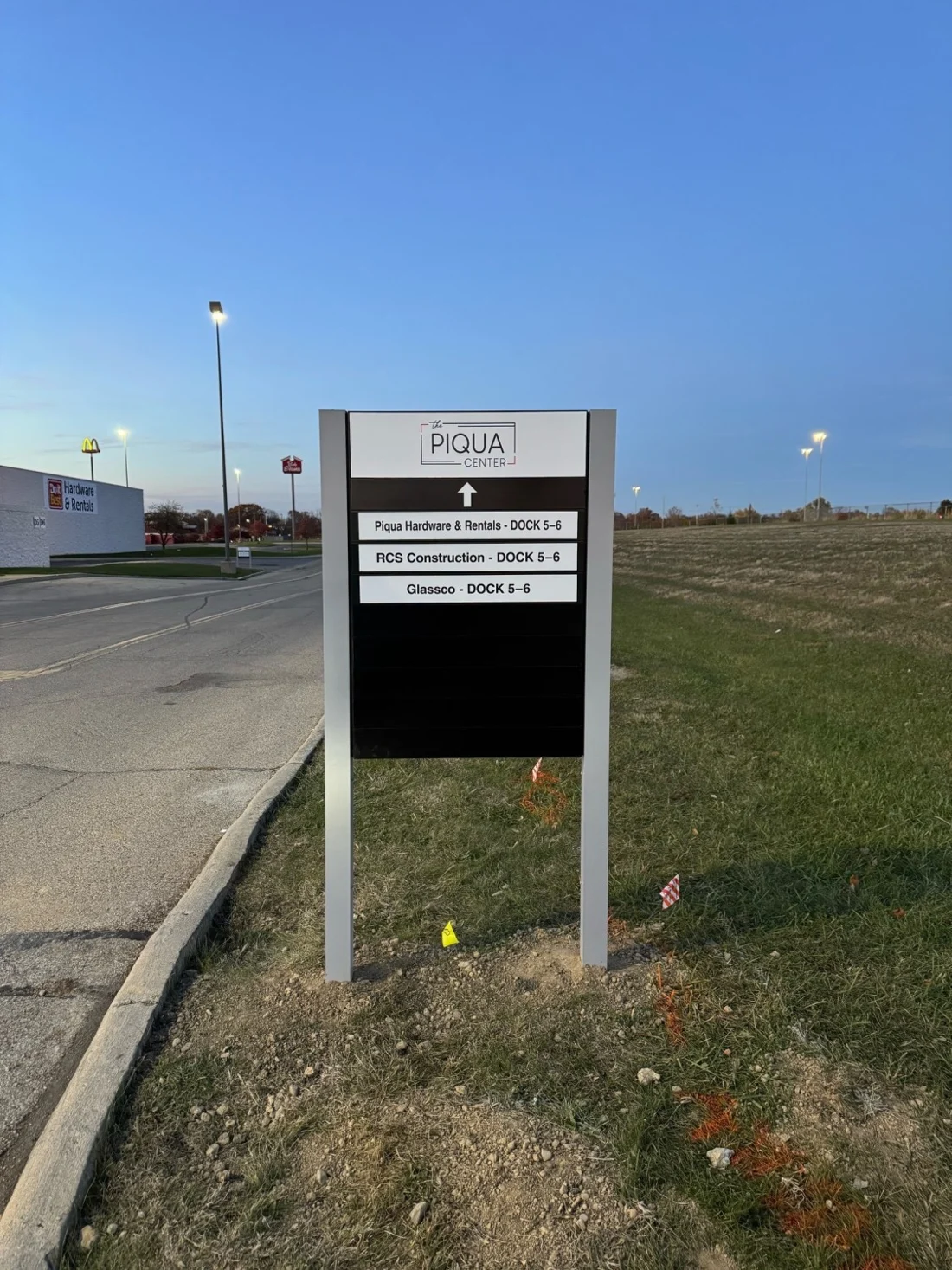
Focused directional sign set
A defined group of signs serving a small site, parking area, trail or building route.
- Destination list and route review
- Sign layouts, panels and mounting hardware
- Field locations and installation
Request a project-specific estimate
Property or campus system
A coordinated exterior-and-interior system spanning arrivals, directories, decision points and destinations.
- Site plans, route audit and message schedule
- Maps, sign family and multiple construction types
- Permitting where applicable, phased production and installation
Request a project-specific estimate
Directory, map or message update
Updated information evaluated against an existing sign structure and navigation system.
- Existing sign dimensions and condition
- Revised tenants, destinations, routes or map artwork
- Matching materials, removal and installation
Request a project-specific estimate
Confirm the included work and exclusions when comparing estimates.
Commercial Sign Pricing Guide U.S. Access Board Sign GuideCompare like with like
What changes the price?
These are the details to put beside a price when you compare proposals.
- Site size, routes & destinations
The number of entrances, zones, destinations and route types determines the planning effort and sign schedule.
Which people and vehicles need to reach which destinations?
- Survey & location planning
Sight lines, travel direction, decision timing, available space and existing signs affect each location.
Has every proposed location been reviewed from the viewer’s approach?
- Sign quantity & construction types
A system may combine maps, directories, post-mounted panels, wall signs, suspended signs and larger freestanding structures.
Does the proposal list each sign type, quantity and mounting method?
- Maps, artwork & message development
Map creation, destination hierarchy, icons, bilingual content and unique messages add design and proofing scope.
Who owns the approved source information and final naming list?
- Materials, durability & changeability
Exterior exposure, interior finishes, replaceable tenant panels, reflective graphics and vandal resistance affect materials and detailing.
How long must the sign last, and which messages will change?
- Accessibility, permits & installation
Interior directional signs may require accessible visual treatment. Exterior structures can involve permits, foundations, utilities, access and restoration.
Are accessibility review, approvals and complete installation included?
Real Vantage work
Wayfinding projects
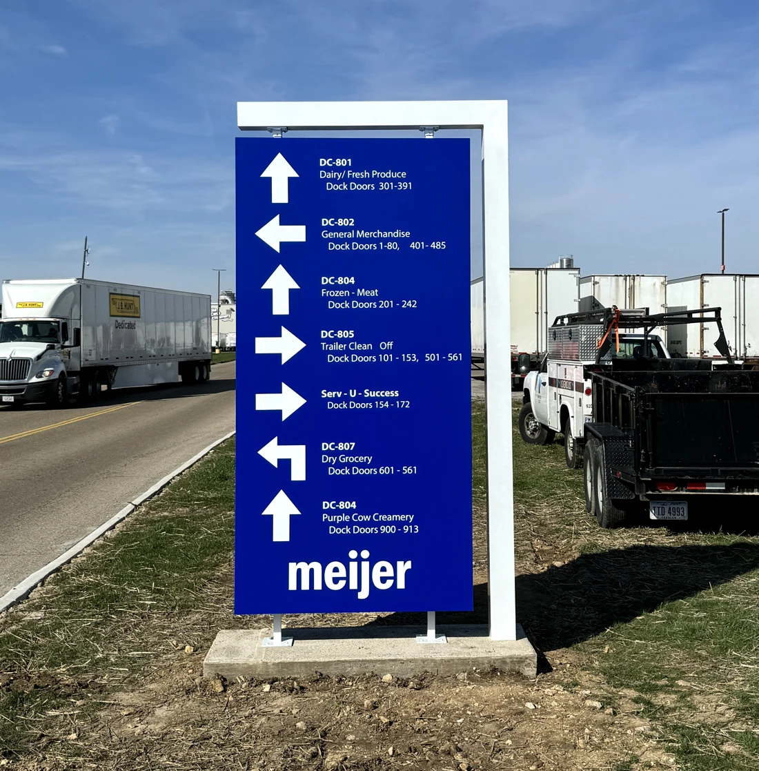
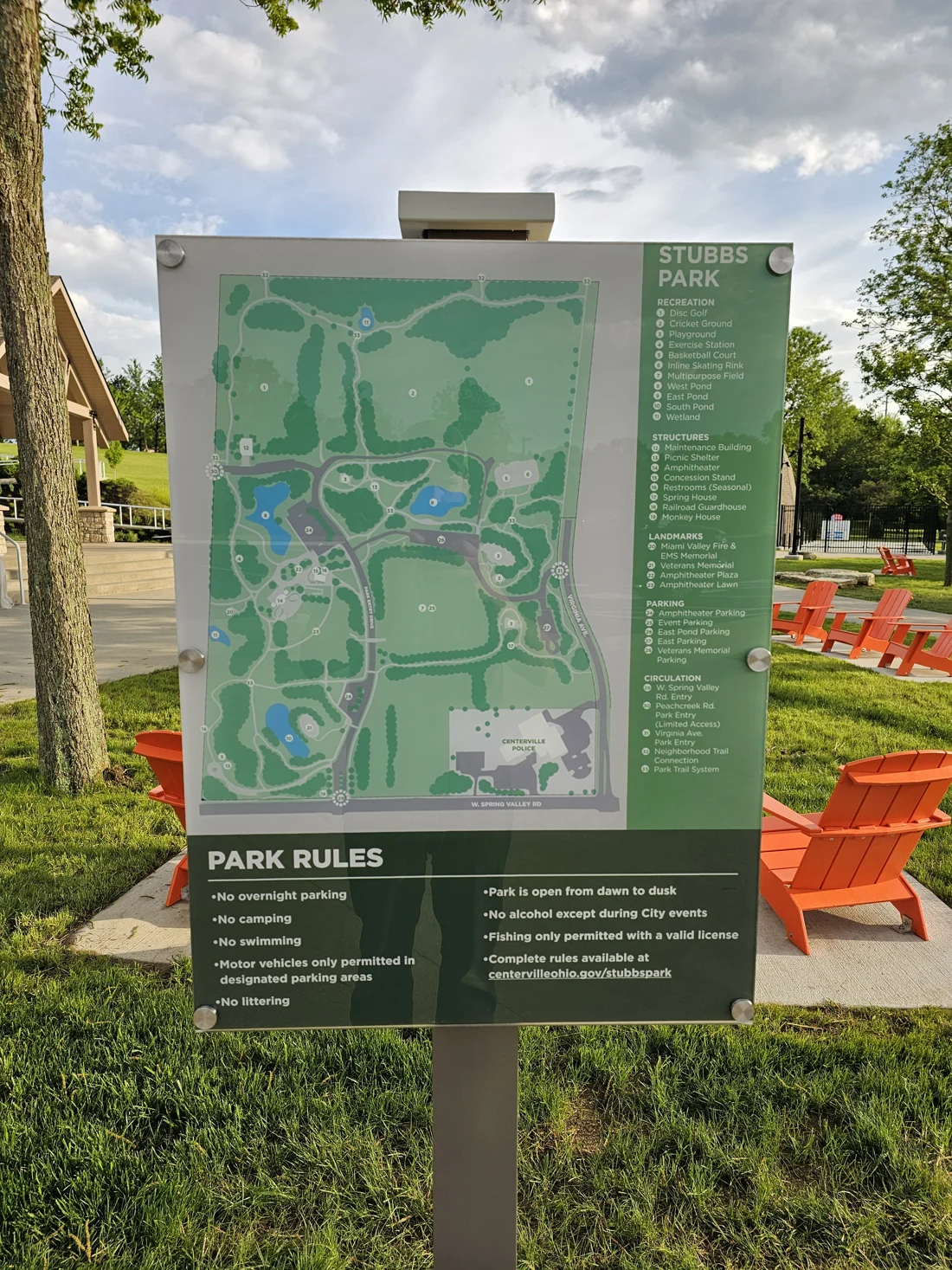
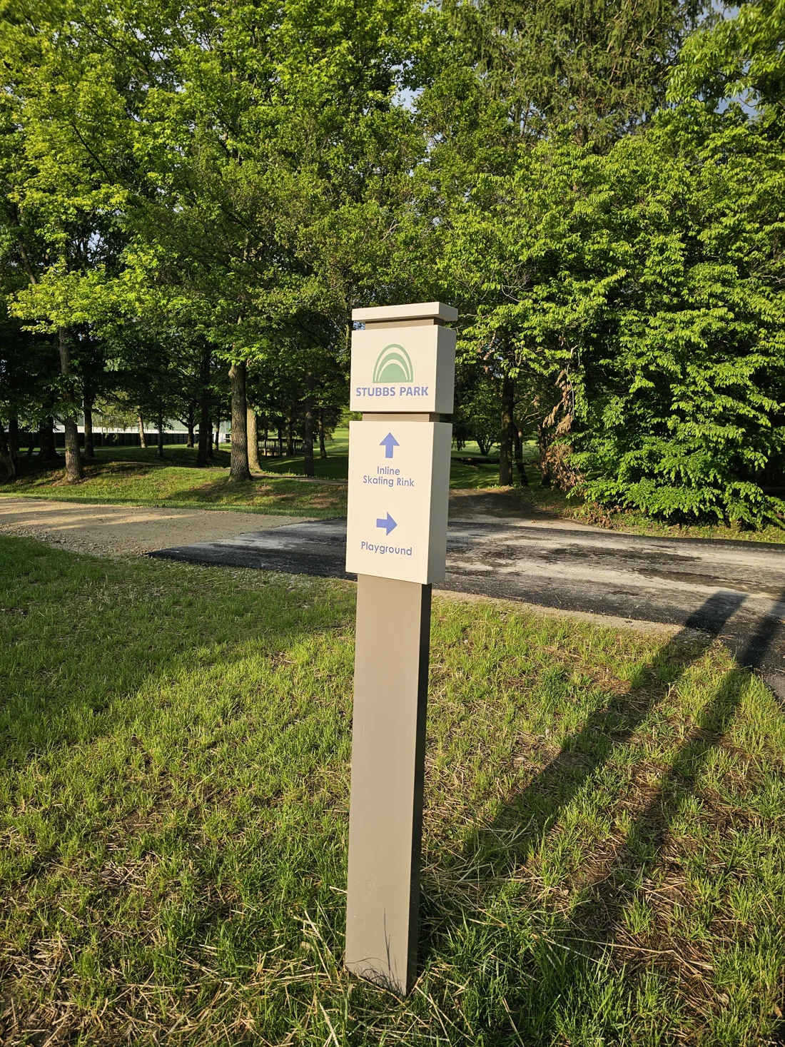
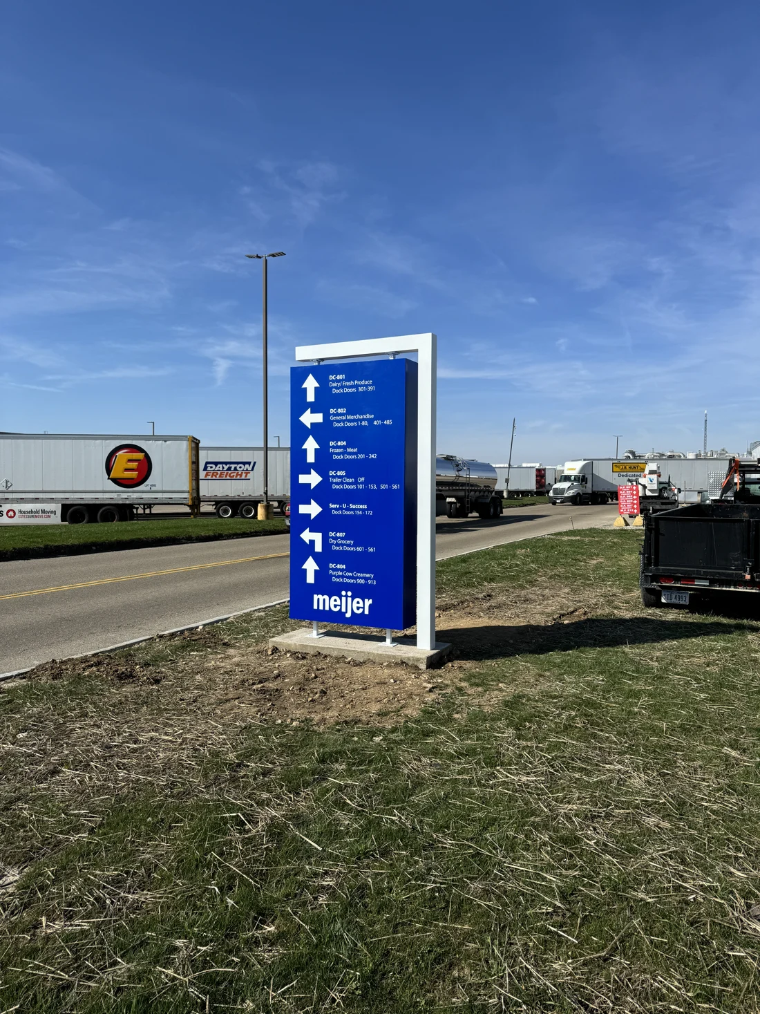
Stubbs Park combines orientation maps and trail directions; Meijer uses large-format directional signs for industrial vehicle circulation.
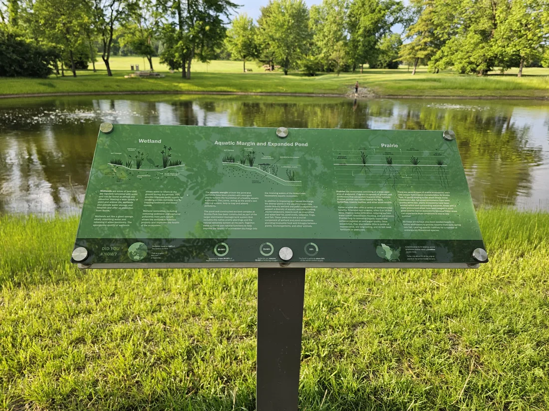
Stubbs Park
Centerville, Ohio
A park wayfinding family combining site orientation, rules and directional signs along pedestrian routes.
- MAP + DIRECTIONS
- Orientation and next-step guidance across the park
- PEDESTRIAN ROUTES
- Information placed at trail and path decision points
Meijer Distribution
Large-format directional signs organize vehicle routes and facility destinations across an active distribution site.
- VEHICLE DIRECTION
- Multiple destinations organized from a roadway approach
- INDUSTRIAL SITE
- Large-format messages for drivers moving through the property
From design to install
Project steps
Review visitor routes
Identify audiences, arrival points, destinations, route options, uncertainty and existing sign gaps.
Build the message schedule
Assign approved names, arrows, maps and sign roles to each location in the route sequence.
Design the family
Coordinate hierarchy, typography, color, symbols, materials and accessibility needs across sign types.
Fabricate by location
Produce maps, panels, structures and mounting details from the approved schedule and field information.
Install & validate
Place each sign at its scheduled location, then review representative routes for clear continuity.
Considering your options?
Other sign options
ADA Signs
Consider it whenThe primary need is compliant permanent-room identification and the interior directions connected to that room schedule.
ADA signs address accessible room identification and interior information; wayfinding connects the broader route across exterior and interior spaces.
Monument Signs
Consider it whenThe property needs a strong ground-level identity at its main entrance.
A monument confirms the place and brand; a wayfinding system continues the route after arrival.
Post & Panel Signs
Consider it whenA small number of straightforward exterior messages can be handled with economical freestanding panels.
Post-and-panel describes one construction type; wayfinding is the complete information and route system that may use it.
Often paired with
ADA Signs Connect the broader route to accessible interior identification.
Monument Signs Begin the visitor journey with a clear property entrance.
Pylon Signs Make the correct site visible before the driver reaches the entrance.
Before you start
Questions
Where should a wayfinding project start?
Start with the people, vehicles, entrances and destinations—not the sign shapes. Walk or drive the routes, identify decision points and agree on one destination naming list before laying out individual signs.
How many directional signs do we need?
The count depends on the route and the decisions along it. Provide enough information before every meaningful turn and confirm arrival at important destinations without repeating a full directory at every location.
Should interior and exterior wayfinding match?
They should feel like one system and use consistent destination names and hierarchy. Materials, scale and mounting can change between exterior roads, pedestrian paths, lobbies and corridors.
How do ADA signs relate to wayfinding?
ADA signs focus on accessible identification and communication requirements, especially for permanent rooms and spaces. Interior directional signs belong in the navigation system and may have accessible visual requirements. Plan both from the same floor plans and destination schedule.
Can an existing directory or map be updated?
Often, but the existing dimensions, message capacity, structure, materials and graphic files must be reviewed. A changed tenant list or route may also affect downstream directional signs.
What should we provide for a quote?
Share site and floor plans, destination and tenant lists, known problem areas, photos of existing signs, brand standards, access restrictions and the target schedule. Mark information that is still changing.
Let’s map the route before we make the signs.
Send your site or floor plans, destination list, existing-sign photos and known navigation problems. We’ll help organize the journey, message schedule, sign family and installation scope.
Start a project