Industries
Municipal & Community
Help people recognize the place, understand the route and find the right destination across an entire public environment.
Documented work
Related work
Real projects connect the planning decisions to finished signs and field execution.
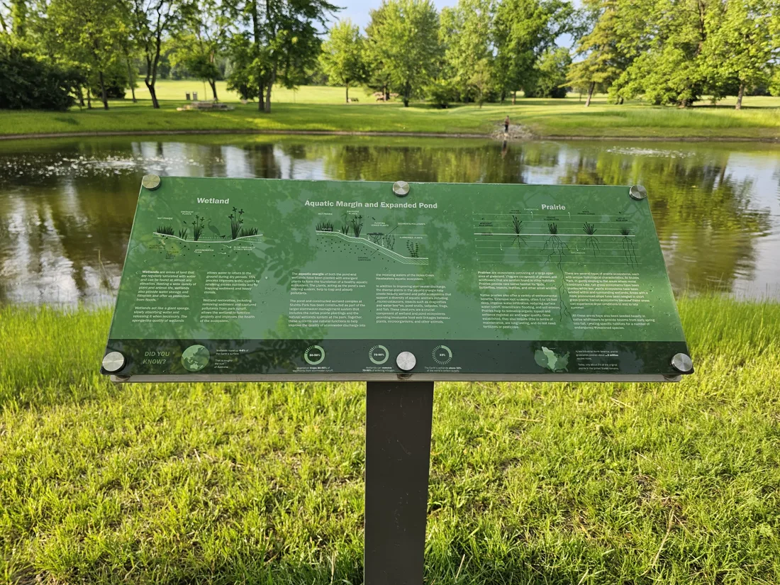
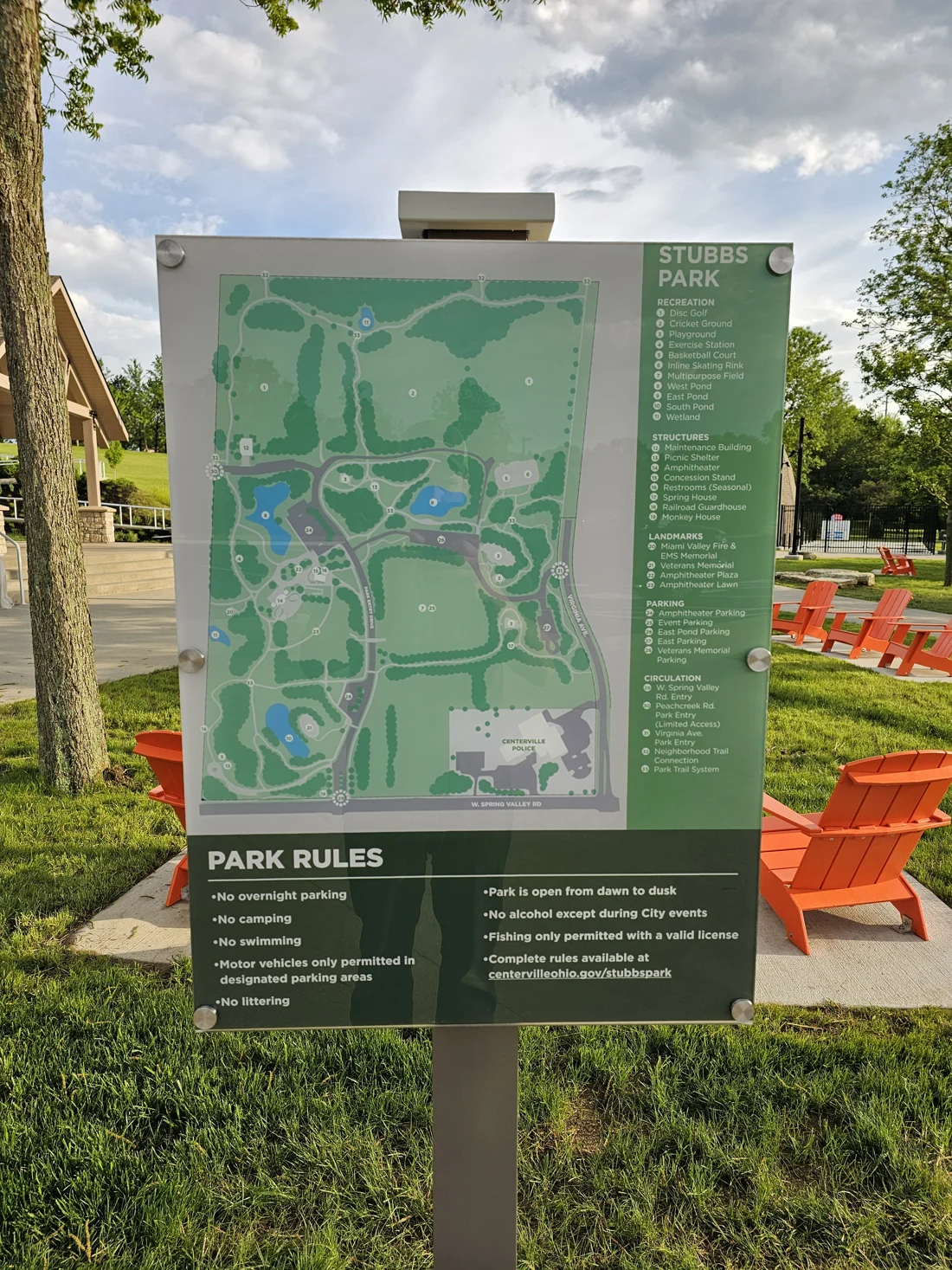
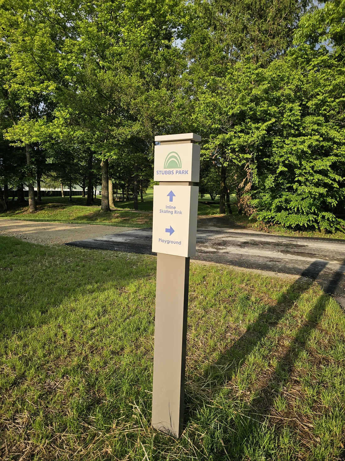
Stubbs Park
Centerville, Ohio
A park wayfinding family combining site orientation, rules and directional signs along pedestrian routes.
- MAP + DIRECTIONS
- Orientation and next-step guidance across the park
- PEDESTRIAN ROUTES
- Information placed at trail and path decision points
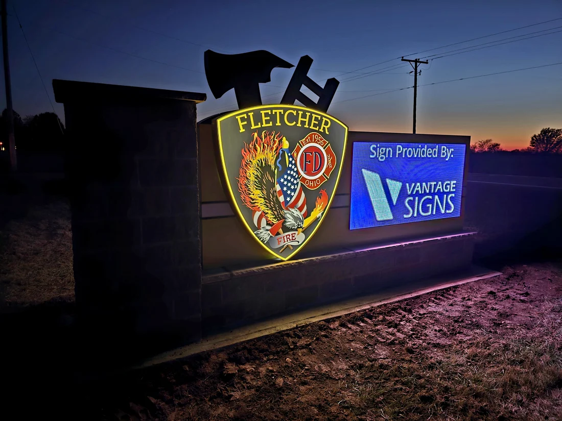
Fletcher Fire Department
Fletcher, Ohio
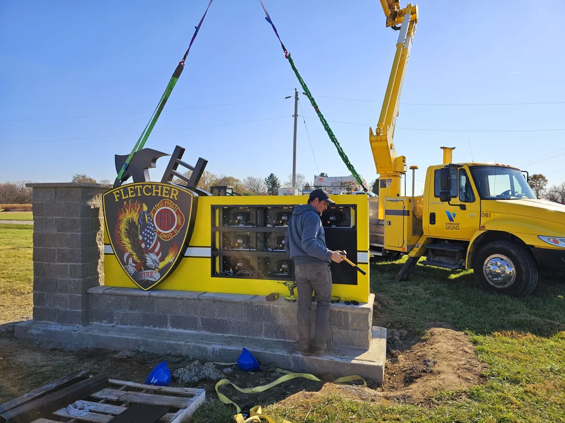
A public-safety entrance sign combines Fletcher Fire Department identification with an electronic message display in one freestanding structure.
- IDENTITY + EMC
- Fixed public-safety identification with a changing message area
- CRANE ACCESS
- Field installation documented at the entrance structure
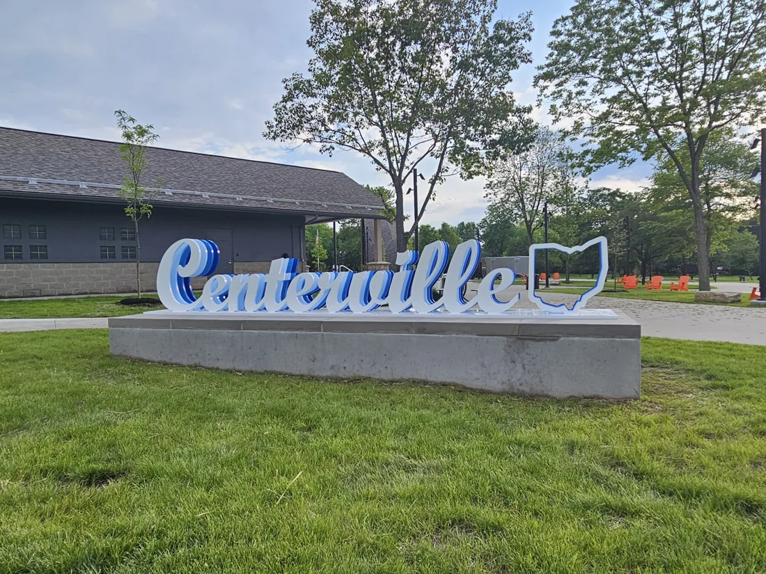
Centerville
Centerville, Ohio
A dimensional park identity feature designed as a recognizable public landmark and photo-op backdrop.
- DIMENSIONAL LETTERS
- Park identity built as a public landmark
- PHOTO-OP BACKDROP
- A destination marker for the park setting
The signage system
Signage needs
Individual sign types make more sense after the place, routes and communication needs are understood.
Identify the place
Make arrival unmistakable.
Entrances, facilities and community destinations need clear identification that fits the setting and remains readable from the approach.
Help people find their way
Plan the route before the signs.
Vehicular and pedestrian systems use different viewing distances, speeds and decision points. Consistent destination names connect entrances, parking, paths and final destinations.
Communicate changing information
Give current messages a defined place.
An electronic message center can carry changing information while permanent identification keeps the facility recognizable. Power, visibility, message management and approvals belong in the plan.
Make spaces understandable
Carry the system through the door.
Room identification, accessibility signs and interior directions extend the same naming and route logic into public-facing buildings and facilities.
System thinking
One environment. Several kinds of information.
Stubbs Park shows why the system comes first. A visitor may need orientation, rules, destination names and a directional cue at different moments along the same visit. Each sign has a specific job, but the messages and visual language need to stay connected.
Plan for the site
Site planning
A complete scope connects communication needs with the actual surfaces, utilities, approvals and installation conditions.
Multiple locations & message schedules
A complete location plan and approved message list keep several signs, destinations and phases coordinated.
Vehicular vs. pedestrian viewing
Drivers need fewer words, larger messages and decisions placed before the turn. Pedestrians can use maps, rules and more detailed destination information.
Site survey & visibility
Approach direction, grades, landscaping, setbacks, utilities and existing circulation affect where a sign can work.
Accessibility & consistency
Public-facing systems should carry consistent room names, destinations and route language. Project-specific accessibility requirements must be reviewed in the actual scope.
Exterior exposure & maintenance
Materials, finishes, drainage, illumination and service access should respond to weather, public use and long-term upkeep.
Approvals, power & installation access
Permits, engineering where required, electrical provisions, equipment access and active public spaces affect the field plan.
A coordinated project
Project steps
The useful constant is one coordinated source for locations, messages, drawings and approvals.
Survey the place
Document entrances, routes, destinations, existing signs, utilities, sight lines and the conditions around each proposed location.
Project CoordinationPlan the system
Build the location plan, message schedule and hierarchy around the decisions visitors need to make.
Project CoordinationDesign the family
Coordinate sign forms, typography, color, materials and map or message content across the system.
DesignConfirm approvals
Identify the drawings, engineering, permitting, electrical work and stakeholder reviews required for the actual scope.
Engineering & PermittingFabricate the pieces
Produce the approved structures, panels, graphics, dimensional elements and illumination as one coordinated release.
FabricationInstall in sequence
Plan crews, equipment, site access and public-space coordination around each location and project phase.
InstallationPlanning investment
Project scope
There is no useful industry-wide average. Start with the actual sign configurations, quantities and sites.
Individual identification
A facility, park entrance or community destination with one defined sign and site condition.
Focused navigation set
A coordinated group serving an entrance, parking area, trail, building or limited destination network.
Multi-location sign system
Several identification, directional, informational and communication elements planned across a broader environment.
Industry FAQ
Questions
Can Vantage handle multiple signs or locations as one project?
Yes. A multi-sign scope should begin with a location plan, message schedule, site information and the sequence in which areas will be ready. Vantage can coordinate the design, fabrication and field installation around the defined system.
Explore project coordinationCan you help plan a wayfinding system?
Yes. Planning starts with entrances, destinations, visitor routes and the decision points where people need information. That route logic determines the useful sign locations and messages.
Explore WayfindingDo you handle permitting and engineering?
Project planning identifies the drawings, engineering and permit coordination required for the proposed signs. Requirements and responsibilities depend on the location and scope and should be confirmed for the project.
Engineering & permittingCan an electronic message center be incorporated into a municipal sign?
Yes, when a changing-message area fits the communication need and the site supports visibility, power, access and the applicable approvals. The permanent identity and digital display should be designed as one sign composition.
Electronic Message CentersCan Vantage fabricate and install the signage?
Vantage fabricates approved sign components in Troy and plans field installation around the structures, equipment, access and site conditions required for the work.
Explore installationHow early should signage planning begin?
Begin while routes, destination names, site work, power and construction responsibilities can still be coordinated. Early planning is especially useful when several locations, foundations, building interfaces or approvals are involved.
See project coordinationPlan the signs around the whole place.
Send the site, destination list, available plans, existing-sign photographs and target schedule. We’ll help define the system and the next useful step.
Start a municipal signage project